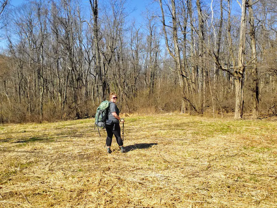
Getting to Shenandoah
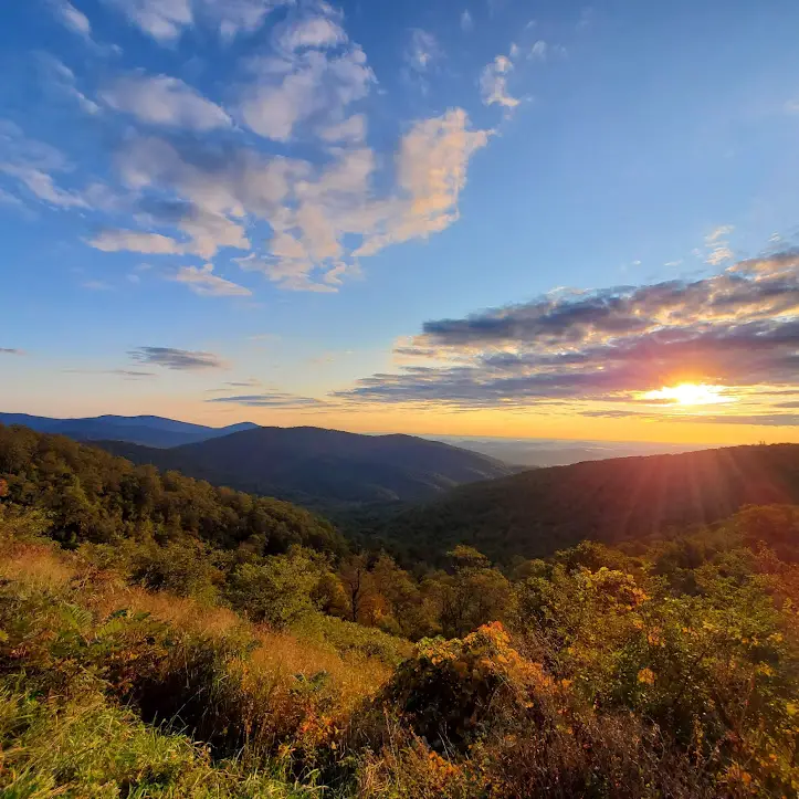
Shenandoah is often associated with the town of Luray. Many tourists will stay in that area and visit the park on a day trip. However, Shenandoah stretches all the way from Front Royal, Virginia down to North of Waynesboro, VA. There are boundary hikes all around, but there are only 4 main entrances to hop on Skyline Drive, which is the one main road that goes directly through the park.
Front Royal (North)
Thornton Gap (East)
Swift Run Gap (West)
Rockfish Gap (South)
The park is about 75 miles from Washington, D.C. You can fly into multiple airports including Dulles (IAD) and Reagan (DCA), or Charlottesville-Albemarle (CHO) if you want to come in the South entrance.
Fees & Cancellation Stamp
There is a $30 fee to enter Skyline Drive, but the pass is good for 7 consecutive days. You can also use your America the Beautiful pass for free entry.
Other fees that might be important to you:
Camping: $30 per night at all campgrounds. No hook-ups in the park.
Showers: $2.50 (quarters only) per 5 minutes, available at Big Meadows, Lewis Mountain, and Loft Mountain campgrounds only.
You can get your stamp at either the Dickey Ridge or Harry F. Byrd Visitor Centers. Dickey Ridge is in Front Royal (Mile 4.6) and Harry F. Byrd is in the Big Meadows area (Mile 51).
Time Required in Shenandoah
This entirely depends on if you want to camp and how much hiking you want to do. There are over 500 miles of hiking trails in Shenandoah. Once I finish more reviews of all the parks, I will come back and create itineraries for all the scenarios listed below.
For the non-hiker – 1 full day
One or two hikes – 1 night, 2 days
Campers who also wish to hike – 3 nights, 4 days
Campers who are avid hikers – 5 nights, 6 days
Camping inside Shenandoah
There are 4 main campgrounds. Click the links for maps of the campgrounds.
Mathews Arm (Mile 22.1)
Big Meadows (Mile 51.2)
Lewis Mountain (Mile 57.5) – tent sites are first come first serve only
Loft Mountain (Mile 79.5)
While RVs are allowed at all 4 campgrounds, there are no hook-ups in the park. There is potable water and dump stations available. Lewis Mountain is first-come, first-served only. Mathews Arm and Loft Mountain have a combination of FCFS and reservable sites. As of 2023, Big Meadows is moving to a reservation only system. According to the NPS site, here is how the sties will be released:
6 months prior to the date of your arrival – 50% of reservable sites will be released
2 weeks prior to the date of your arrival – 25% of reservable sites will be released
4 days prior to the date of your arrival – the remaining 25% of reservable sites will be released
You can show up and make a reservation the day of, but nothing is guaranteed and no amount of sites will be set aside for walk-ups, as was true in the past.
Lodging inside Shenandoah
Skyland (Mile 41.7) – Lodging ranges from premium rooms to detached private cabins. Options are spread out across 28 different buildings over 27 acres.
Big Meadows Lodge (Mile 51) – There are rooms in the lodge, or you can get a private detached cabin. Enjoy breakfast, lunch, or dinner at the Spottswood Dining Room, or grab a drink in the New Market Taproom. The views from the Terrace seating can’t be beat. There is also a small “to-go” section in the lobby of the lodge that has packaged food, drinks, and coffee. Another unique option is that you can order a boxed lunch to take with you for on the trail.
Lewis Mountain Cabins (Mile 57.5) – You can rent one or two room cabins, or a hiker’s cabin. The one and two bedroom cabins include towels and linens and a bathroom. The hiker’s cabin is a bit more primitive, with no linens provided. It has a pot belly stove for heating and firewood is supplied (nice perk!).
Things to do in Shenandoah
Rapidan Camp (Mile 51)
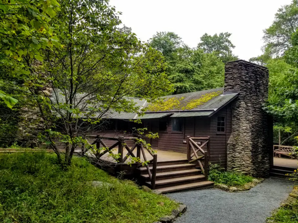
Rapidan Camp was President Herbert Hoover’s mountain getaway. There is a shuttle that can drive you down to the camp. The drive takes about an hour each way due to the low speed limit and it being a dirt fire road. However, the rangers talk and give information the entire time. When I went, we saw a black bear and her cubs! The shuttle costs $10 and must be reserved in advance through recreation.gov.
Massanutten Lodge (Mile 41.7)
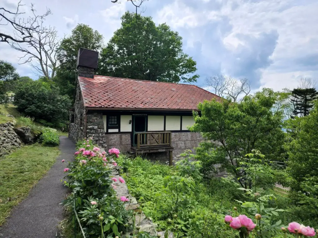
The lodge is only open specific hours and days of the week. For reference, it open 2-5pm every Monday, Wednesday, Friday, and Saturday for the 2022 season.
The lodge is small and does not require much time to visit. Only one floor is open – one side with informational signs, and one side with period furniture and a park ranger to answer questions.
Visitor Center Exhibits
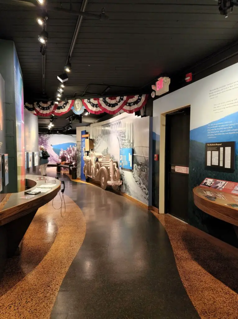
This is the the beginning portion of the exhibits in the Harry F. Byrd visitor center. There is another portion around the corner that is about this same length. At the end there is some information/stats about the Appalachian Trail.
There are also exhibits at Dickey Ridge, but I have not been to that visitor center yet.
Appalachian Trail
101 miles of the Appalachian Trail run through SNP. For avid hikers I recommend all of it! For the occasional or curious hiker, I recommend parking at Elkwallow Wayside and walking either North or South (South is easier) for as long as you’d like. Turn back around and get a blackberry shake from the market as a reward.
Shopping, Food, Gas
There are currently 6 locations that offer both food and souvenirs inside Shenandoah:
1) Elkwallow Wayside (Mile 24.1) – Made-to-order items & groceries
2) Skyland (Mile 41.7 & 42.5) – Full dining service, taproom, and grab n’ go options
3) Big Meadows Wayside (Mile 51.2) – Made-to-order items and groceries, gas station
4) Big Meadows Lodge (Mile 51.2) – Full dining service, taproom, and grab n’ go options
5) Lewis Mountain Camp Store (Mile 57.5) – Groceries only
6) Loft Mountain Wayside (Mile 79.5) – Made-to-order items
Must-do Hikes inside Shenandoah National Park
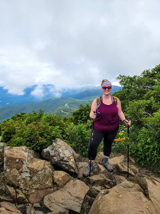
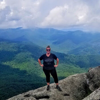
Bearfence Mountain
Distance: 1.4 miles (Moderate) – Out and back
Elevation Gain: 311 feet Map
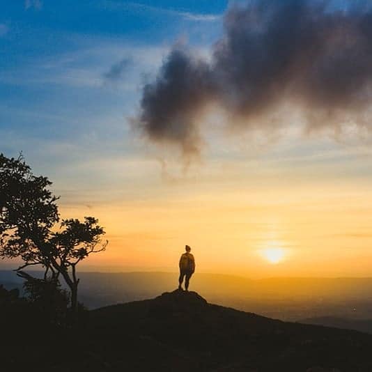
Review: This is a really fun hike, but can be a little nerve-racking. Unlike Old Rag, the rocks you climb over are not as big or smooth. Some are very sharp and pointy, and you definitely have to watch your step. At the top you will have 360 degree views of the park. This is an awesome choice for a sunrise/sunset hike. This picture is from a sunset hike.
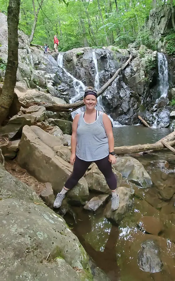
Dark Hollow Falls
Distance: 1.4 miles (Moderate) – Out & back
Elevation Gain: 440 feet Map
Review: This hike is good for the whole family, just beware that all the elevation gain is coming back up, which is only .75 miles. It can get muddy from all the water being dragged up on people’s shoes and clothes from the falls, so wear shoes you don’t mind getting dirty. Due to the proximity to the visitor center and being so family friendly, it’s one of the most popular hikes in the park, so keep that in mind when you pick the time of day to do this hike.
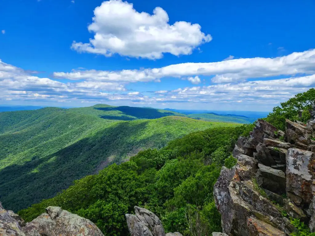
Hawksbill Summit via Upper Hawksbill
Distance: 2.1 miles (Moderate) – Out & Back
Elevation Gain: 520 feet Map
Review: At 4,051 feet, this is the highest peak in Shenandoah. There are multiple ways to hike to Hawksbill, including different parking lots and loop options on or off the AT. The views are amazing, 360 degrees once at the top. There is a field of rocks to hop around on, or there is a nice, flat viewing platform. I did this hike for sunset and it did not disappoint.
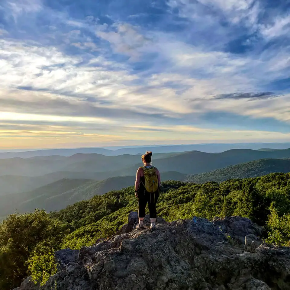
Stony Man (Passamaquody, Furnace Spring, and the AT)
Distance: 4.2 miles (Easy/Moderate) – Loop
Elevation Gain: 1,093 feet
Review: I wanted something a little longer than just to Stony Man and back (which is 1.6 miles), so I combined a few trails. There are even more options if you want something longer or if you want to do more of the AT. I loved each of the trails I was on! Passsamaquoddy was beautiful and Furnace Spring was unlike anything I’ve seen in SNP. It reminded me more of a forest in the PNW. Also, there two amazing lookouts on this loop that are NOT Stony Man, which was a huge bonus.
Rapidan Camp (via Milam Gap parking to Mill Prong Trail)
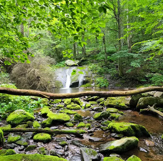
Distance: 4.35 miles (Easy/Moderate) – Out & back
Elevation Gain: 794 feet
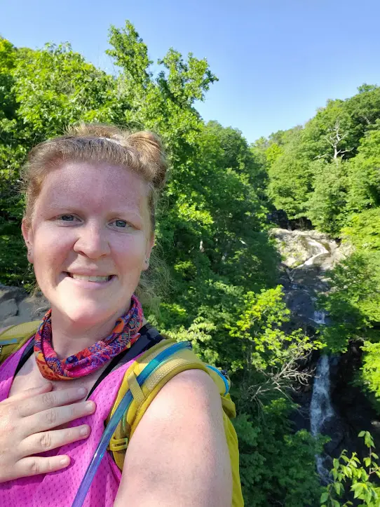
Review: There are dozens of ways to get down to Rapidan Camp. I started at the Milam Gap parking area, took the Mill Prong trail down to the split, where I then hopped on the Horse Trail that takes you into Rapidan. Mill Prong was beautiful, which is where this picture was taken. I have taken a shuttle down to Rapidan before, but wanted to actually hike down. Since I’ve been before I didn’t take many pictures of the camp. See my section on Rapidan for those pictures!
Hawksbill Summit via Rock Spring Cabin parking
Distance: 4.84 miles (Moderate) – Loop
Elevation Gain: 1,262 feet
Review: I started at the Rock Spring Cabin parking area. Then, I took the AT North and veered off onto Salamander, which eventually dumped me at the Hawksbill Summit. I took Lower Hawksbill down and crossed the road onto the AT South. It was a great hike, only one real ascent and I got to check Salamander off my list in the process.
Mary’s Rock via Pinnacles Picnic Grounds
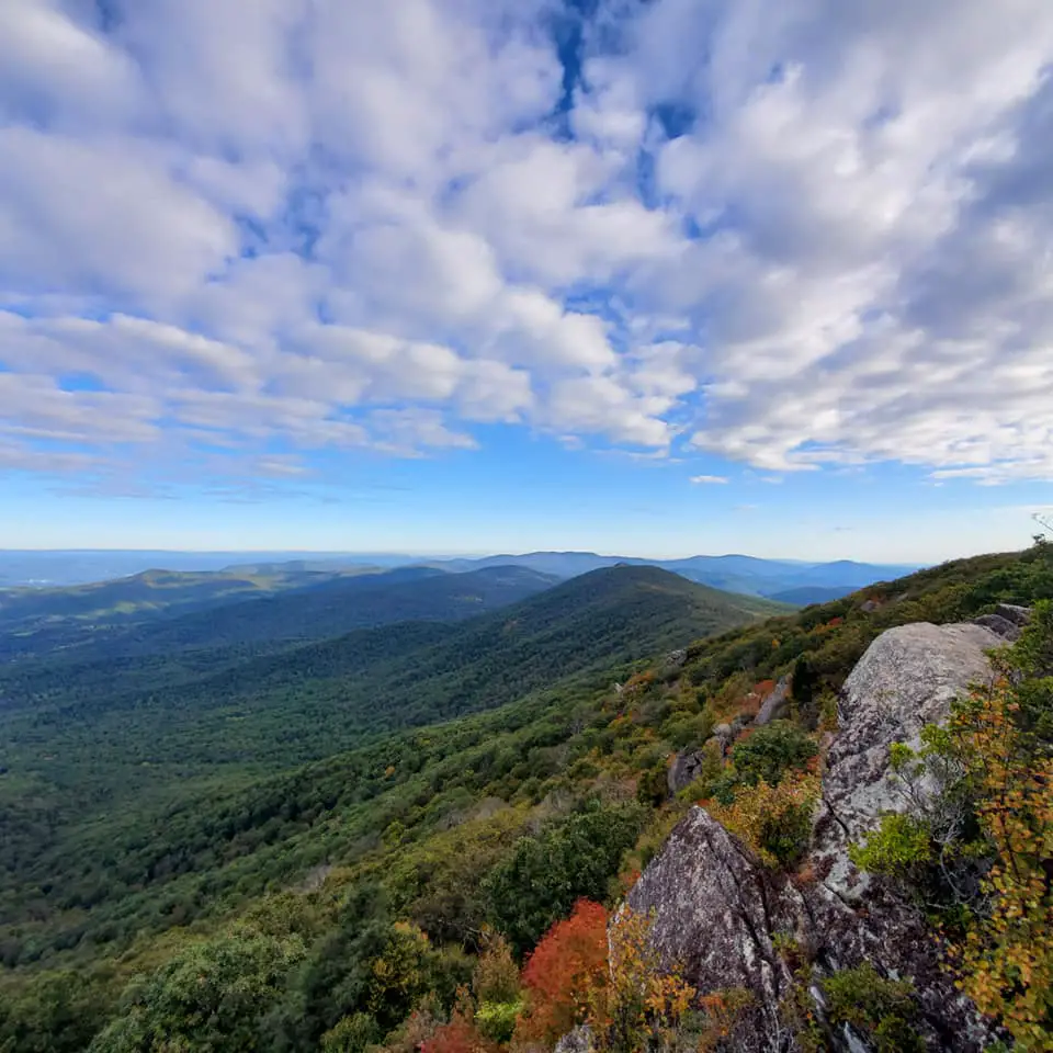
Distance: 7 miles (Moderate) – Out & back
Elevation Gain: 1,391 feet
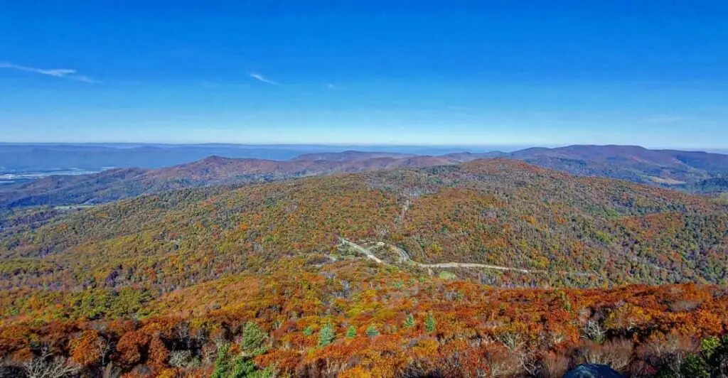
Review: This is one of my favorite hikes in SNP. It’s all on the AT until the spur. Just like Hawksbill, there are a few different ways you can do this hike. There is a nice view right at the beginning and there are other cool rock features and an AT shelter along the way. Both times I’ve done this hike were in the fall, which I highly recommend for the fall foliage.
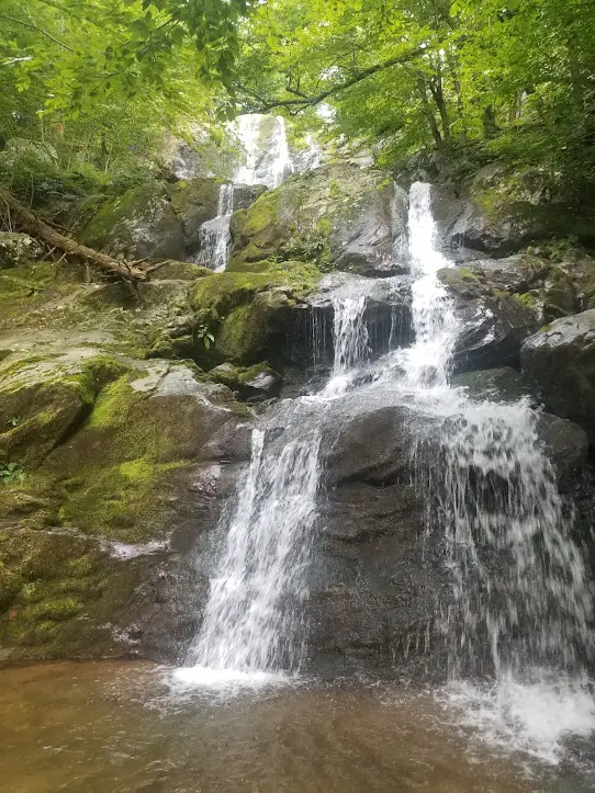
Rose River Trail to Story of the Forest Trail Loop
Distance: 7 miles (Moderate) – Loop
Elevation Gain: 1,552 feet Map
Review: If you follow the All Trails directions, this trail isn’t so bad. However, I started this loop in Big Meadows (the middle of the hike), which meant I basically did all of the elevation gain at the end. Rose River Falls and the river you follow is absolutely beautiful. There are so many spots you could stop and swim. This loop is a nice way to see both sets of falls if you want something a little harder than just Dark Hollow Falls.
Jones Run Falls & Doyles River Loop
Distance: 7.2 miles (Moderate) – Loop
Elevation Gain: 1,400 feet Map
Review: I started at Browns Gap and went about a half-mile on the AT before turning onto the Jones Run Falls trail. I didn’t know there was a trailhead specifically for this loop, which is why I started at Browns Gap. There is no need to start where I did unless you’d like a little more mileage. If you do start at Browns Gap, I highly recommend starting on the AT and ending on the fire road, you will have way better of a time. The entire trail is beautiful, let alone the falls. Once you pass Jones Run Falls, you follow Doyle’s River for about 1.3 miles, which is the hardest part of the hike. It’s constant cascades and waterfalls – one of my favorite hikes in the park.
White Oak Canyon/Cedar Run Loop
Distance: 9 miles (Hard) – Loop
Elevation Gain: 2,372 feet Map
Review: Since this a loop, there are several ways to start the hike, and you don’t even have to do the whole loop if you don’t want to. In my opinion, the best way to start is from the boundary parking lot. From there, go up White Oak Canyon and down Cedar Run. This means all the uphill is first, with waterfalls every so often as a reward. Also, doing it this way means the natural water slide and cliff jumping is at the end, which is the ultimate reward. This area can get pretty busy because large groups of people like to hike in with food and towels and sit for hours. It’s fine though, plenty of people to take your picture!
Old Rag
Distance: 9.2 miles (Strenuous) – Loop
Elevation Gain: 2,348 feet Map
Review: This is a fun but difficult hike with some intense rock climbing. Upper-body strength is required in some parts. Take EXTRA water and do not be under-prepared for this hike. It is very difficult and can take hours to rescue people off this trail. Although this hike is strenuous, I would not consider it deathly. The rocks you scramble over are large, boulders. You are not right up against the side of a mountain. You could injure yourself if not careful, but you won’t fall off the side of the mountain.
Mary’s Rock via Beahms Gap
Distance: 10.6 miles (Hard) – Out & back
Elevation Gain: 3,086 feet Map
Review: This is a way to get to Mary’s Rock coming from the other direction and it was brutal. There are 3 fairly big inclines if done as an out and back. It was hard, but I loved it. If you are looking for a longer hike and upping your elevation gain, I highly recommend
Insider Scoop
My best advice for day trippers is to leave your house early. I leave early enough to see the sunrise, if that’s too early I still recommend beating the crowds. Once the bikers are out around 9 or 10am, Skyline Drive can get very congested from May-November. You don’t want to risk not finding a parking spot.
I love Big Meadows Campground. It’s so central to everything and they offer more ranger programs than other areas of the park. A ton of hikes are right in the Big Meadows area, so you might not even have to move your car. This is a huge benefit if you want to have a slow morning at camp. Big Meadows Wayside has the cheapest and biggest variety of souvenirs. They also have a bunch of unique, hand-crafted items.
My most important piece of advice: get a shake at Elkwallow Wayside.
Last Updated: April 5, 2023
Leave a Reply